Carpinis, Brașov, Romania Climate
Weather: 19.46°C/67.03°F, Wind SW at 6.13 km/h, 38% Humidity, 0% Chance of rain
Carpinis Climate Summary
Located at an elevation of None meters (0 feet) above sea level, Carpinis has a Humid continental, no dry season, warm summer climate (Classification: Dfb). The district’s yearly temperature is 9.15ºC (48.47ºF) and it is -3.71% lower than Romania’s averages. Carpinis typically receives about 136.12 millimeters (5.36 inches) of precipitation and has 181.4 rainy days (49.7% of the time) annually.
| Country | Romania |
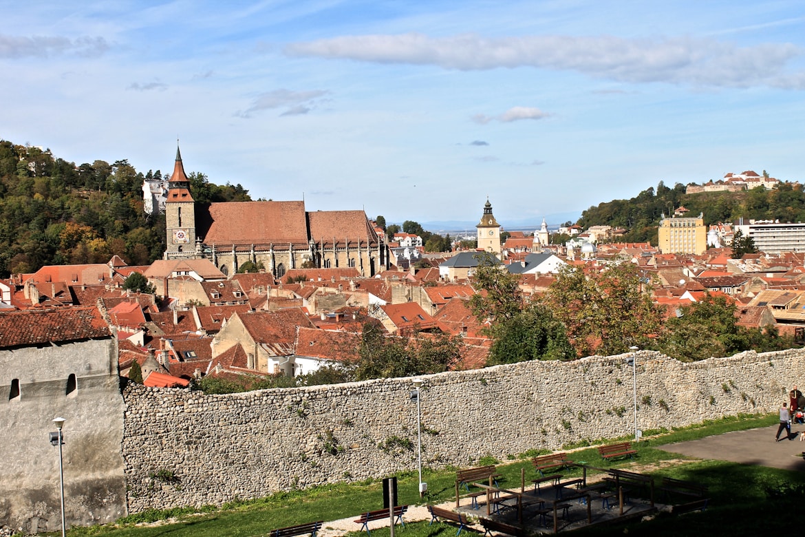
| City | Brașov |
| Longitude | 25.7669396 |
| Latitude | 45.6623253 |
| Attitude/Elevation | Nonem (0ft) |
| Local time | Friday 14:21 |
| Annual high temperature | 12.09ºC (53.76ºF) |
| Annual low temperature | 2.97ºC (37.35ºF) |
| Average annual precip. | 136.12mm (5.36in) |
| Warmest month | August (24.41ºC / 75.94ºF) |
| Coldest Month | January (-7.79ºC / 17.98ºF) |
| Wettest Month | June (255.57mm / 10.06in) |
| Driest Month | November (71.99mm / 2.83in) |
| Number of days with rainfall (≥ 1.0 mm) | 181.4 days (49.7%) |
| Days with no rain | 183.6 days (50.3%) |
| Humidity | 80.74% |
Climate Carpinis: Weather By Month
| Month | Jan | Feb | Mar | Apr | May | Jun | Jul | Aug | Sep | Nov | Oct | Dec | Year |
|---|---|---|---|---|---|---|---|---|---|---|---|---|---|
| Record high °C (°F) | 9.17(48.51) | 14.26(57.67) | 17.32(63.18) | 25.46(77.83) | 27.5(81.5) | 33.61(92.5) | 31.58(88.84) | 33.61(92.5) | 31.58(88.84) | 25.46(77.83) | 20.37(68.67) | 13.24(55.83) | 33.61(92.5) |
| Average high °C (°F) | -1.25(29.75) | 1.13(34.03) | 5.92(42.66) | 12.03(53.65) | 17.04(62.67) | 21.34(70.41) | 23.41(74.14) | 24.41(75.94) | 19.56(67.21) | 12.97(55.35) | 7.79(46.02) | 0.72(33.3) | 12.09(53.76) |
| Daily mean °C (°F) | -3.9(24.98) | -1.4(29.48) | 3.33(37.99) | 9.21(48.58) | 14.15(57.47) | 18.46(65.23) | 20.28(68.5) | 20.95(69.71) | 15.99(60.78) | 9.6(49.28) | 4.73(40.51) | -1.65(29.03) | 9.15(48.47) |
| Average low °C (°F) | -7.79(17.98) | -5.81(21.54) | -1.94(28.51) | 2.5(36.5) | 6.37(43.47) | 10.4(50.72) | 11.49(52.68) | 12.03(53.65) | 8.47(47.25) | 4.16(39.49) | 0.93(33.67) | -5.09(22.84) | 2.97(37.35) |
| Record low °C (°F) | -25.46(-13.83) | -20.37(-4.67) | -16.3(2.66) | -10.19(13.66) | -3.06(26.49) | 3.06(37.51) | 5.09(41.16) | 5.09(41.16) | -3.06(26.49) | -7.13(19.17) | -11.2(11.84) | -23.43(-10.17) | -25.46(-13.83) |
| Average precipitation mm (inches) | 84.94(3.34) | 91.74(3.61) | 102.66(4.04) | 156.21(6.15) | 235.12(9.26) | 255.57(10.06) | 210.45(8.29) | 143.04(5.63) | 80.42(3.17) | 111.79(4.4) | 71.99(2.83) | 89.48(3.52) | 136.12(5.36) |
| Average precipitation days (≥ 1.0 mm) | 13.24 | 14.17 | 15.74 | 17.41 | 22.87 | 22.41 | 20.83 | 14.91 | 8.89 | 10.19 | 9.08 | 11.66 | 15.12 |
| Average relative humidity (%) | 91.64 | 90.92 | 82.78 | 76.95 | 80.98 | 80.42 | 76.84 | 70.44 | 72.09 | 77.29 | 80.81 | 87.65 | 80.73 |
| Mean monthly sunshine hours | 6.46 | 6.72 | 10.17 | 12.63 | 13.45 | 13.82 | 14.15 | 13.89 | 11.99 | 7.85 | 7.51 | 6.64 | 10.44 |
Climate Graph
The chart below shows the mean monthly temperature and precipitation of Carpinis in recent years.

Carpinis Temperature by Month
| August | 20.95°C | 69.71°F | |
| July | 20.28°C | 68.5°F | |
| June | 18.46°C | 65.23°F | |
| September | 15.99°C | 60.78°F | |
| May | 14.15°C | 57.47°F | |
| October | 9.6°C | 49.28°F | |
| April | 9.21°C | 48.58°F | |
| November | 4.73°C | 40.51°F | |
| March | 3.33°C | 37.99°F | |
| February | -1.4°C | 29.48°F | |
| December | -1.65°C | 29.03°F | |
| January | -3.9°C | 24.98°F |
Historical Data
| Temperature | Max | Average | Min | |
|---|---|---|---|---|
| Max Temperature | 12.22°C (54.0°F) | 5.33°C (41.59°F) | -0.0°C (0°F) | |
| Avg Temperature | 7.13°C (44.83°F) | 1.43°C (34.57°F) | -3.06°C (26.49°F) | |
| Min Temperature | 2.04°C (35.67°F) | -2.65°C (27.23°F) | -6.11°C (21.0°F) | |
| Dew Point | Max | Average | Min | |
| Dew Point | 2.04°C (35.67°F) | -5.5°C (22.1°F) | -14.26°C (6.33°F) | |
| Precipitation | Max | Average | Min | Sum |
| Precipitation | 4.48mm | 0.18in | 0.18mm | 0.01in | 0.0mm | 0in | 5.5mm | 0.22in |
| Snowdepth | 1.22mm | 0.05in | 0.05mm | 0.0in | 0.0mm | 0in | 1.53mm | 0.06in |
| Wind | Max | Average | Min | |
| Wind | 13.24kmh | 8.23mph | 6.76kmh | 4.2mph | 4.07kmh | 2.53mph | |
| Gust Wind | 23.43kmh | 14.56mph | 11.58kmh | 7.2mph | 6.11kmh | 3.8mph | |
| Sea Level Pressure | Max | Average | Min | |
| Sea Level Pressure | 4.48mb | 0.18mb | 0.0mb |

Daily Observations
| Time | Temperature | Dew Point | Humidity | Wind Speed | Pressure | Precipitation |
|---|---|---|---|---|---|---|
| November | ° C | ° F | ° C | ° F | % | Kph | Mph | Hg | Mb | Total (mm/in) |
| 2011-11-01 | 5.09 | 41.16 | -4.07 | 24.67 | 61 | 5.09 | 3.16 | 30.77 | 1042.03 | 0.0 | 0 |
| 2011-11-02 | 5.09 | 41.16 | 1.02 | 33.84 | 84 | 4.07 | 2.53 | 30.83 | 1044.07 | 0.0 | 0 |
| 2011-11-03 | 6.11 | 43.0 | 2.04 | 35.67 | 87 | 6.11 | 3.8 | 30.74 | 1041.01 | 0.0 | 0 |
| 2011-11-04 | 6.11 | 43.0 | 0.0 | 0 | 76 | 9.17 | 5.7 | 30.74 | 1041.01 | 0.1 | 0.0 |
| 2011-11-05 | 7.13 | 44.83 | -2.04 | 28.33 | 62 | 8.15 | 5.06 | 30.77 | 1042.03 | 0.0 | 0 |
| 2011-11-06 | 5.09 | 41.16 | 1.02 | 33.84 | 82 | 10.19 | 6.33 | 30.92 | 1047.12 | 0.0 | 0 |
| 2011-11-07 | 4.07 | 39.33 | 2.04 | 35.67 | 90 | 12.22 | 7.59 | 31.04 | 1051.2 | 0.41 | 0.02 |
| 2011-11-08 | 5.09 | 41.16 | 0.0 | 0 | 79 | 7.13 | 4.43 | 30.95 | 1048.14 | 0.2 | 0.01 |
| 2011-11-09 | 5.09 | 41.16 | -1.02 | 30.16 | 72 | 9.17 | 5.7 | 30.71 | 1039.99 | 0.0 | 0 |
| 2011-11-10 | 3.06 | 37.51 | 0.0 | 0 | 87 | 5.09 | 3.16 | 30.8 | 1043.05 | 4.48 | 0.18 |
| 2011-11-11 | -2.04 | 28.33 | -7.13 | 19.17 | 73 | 5.09 | 3.16 | 31.07 | 1052.21 | 0.31 | 0.01 |
| 2011-11-12 | -2.04 | 28.33 | -9.17 | 15.49 | 62 | 5.09 | 3.16 | 31.16 | 1055.27 | 0.0 | 0 |
| 2011-11-13 | -1.02 | 30.16 | -7.13 | 19.17 | 71 | 5.09 | 3.16 | 31.19 | 1056.29 | 0.0 | 0 |
| 2011-11-14 | -0.0 | 0 | -5.09 | 22.84 | 77 | 6.11 | 3.8 | 31.01 | 1050.18 | 0.0 | 0 |
| 2011-11-15 | -0.0 | 0 | -6.11 | 21.0 | 71 | 6.11 | 3.8 | 30.8 | 1043.05 | 0.0 | 0 |
| 2011-11-16 | -0.0 | 0 | -6.11 | 21.0 | 73 | 4.07 | 2.53 | 30.83 | 1044.07 | 0.0 | 0 |
| 2011-11-17 | -0.0 | 0 | -5.09 | 22.84 | 76 | 4.07 | 2.53 | 30.92 | 1047.12 | 0.0 | 0 |
| 2011-11-18 | 1.02 | 33.84 | -7.13 | 19.17 | 59 | 8.15 | 5.06 | 30.86 | 1045.08 | 0.0 | 0 |
| 2011-11-19 | 2.04 | 35.67 | -8.15 | 17.33 | 55 | 5.09 | 3.16 | 30.83 | 1044.07 | 0.0 | 0 |
| 2011-11-20 | 0.0 | 0 | -10.19 | 13.66 | 52 | 5.09 | 3.16 | 30.86 | 1045.08 | 0.0 | 0 |
| 2011-11-21 | -0.0 | 0 | -11.2 | 11.84 | 49 | 5.09 | 3.16 | 30.89 | 1046.1 | 0.0 | 0 |
| 2011-11-22 | -0.0 | 0 | -12.22 | 10.0 | 43 | 5.09 | 3.16 | 30.86 | 1045.08 | 0.0 | 0 |
| 2011-11-23 | -0.0 | 0 | -9.17 | 15.49 | 56 | 4.07 | 2.53 | 31.04 | 1051.2 | 0.0 | 0 |
| 2011-11-24 | -1.02 | 30.16 | -4.07 | 24.67 | 82 | 6.11 | 3.8 | 31.16 | 1055.27 | 0.0 | 0 |
| 2011-11-25 | -0.0 | 0 | -8.15 | 17.33 | 63 | 6.11 | 3.8 | 31.1 | 1053.23 | 0.0 | 0 |
| 2011-11-26 | -3.06 | 26.49 | -10.19 | 13.66 | 64 | 10.19 | 6.33 | 30.92 | 1047.12 | 0.0 | 0 |
| 2011-11-27 | -2.04 | 28.33 | -8.15 | 17.33 | 72 | 9.17 | 5.7 | 30.92 | 1047.12 | 0.0 | 0 |
| 2011-11-28 | -2.04 | 28.33 | -7.13 | 19.17 | 69 | 13.24 | 8.23 | 30.86 | 1045.08 | 0.0 | 0 |
| 2011-11-29 | -0.0 | 0 | -8.15 | 17.33 | 62 | 6.11 | 3.8 | 31.01 | 1050.18 | 0.0 | 0 |
| 2011-11-30 | 1.02 | 33.84 | -14.26 | 6.33 | 37 | 7.13 | 4.43 | 30.92 | 1047.12 | 0.0 | 0 |
Carpinis 11 Year Historical Weather Data
- Carpinis, Brașov weather in November 2010
- Carpinis, Brașov weather in November 2012
- Carpinis, Brașov weather in November 2013
- Carpinis, Brașov weather in November 2014
- Carpinis, Brașov weather in November 2015
- Carpinis, Brașov weather in November 2016
- Carpinis, Brașov weather in November 2017
- Carpinis, Brașov weather in November 2018
- Carpinis, Brașov weather in November 2019
- Carpinis, Brașov weather in November 2020
Nearby locations
- Budila 3.24 km ( 2.01 mi)
- Harman 8.18 km ( 5.08 mi)
- Lunca Calnicului 9.99 km ( 6.21 mi)
- Dalghiu 14.94 km ( 9.29 mi)
- Colonia Bod 16.51 km ( 10.26 mi)
- Halchiu 20.50 km ( 12.74 mi)
- Buzaiel 22.12 km ( 13.74 mi)
- Colonia Reconstructia 23.87 km ( 14.83 mi)
- Codlea 24.54 km ( 15.25 mi)
- Colonia 1 Mai 27.83 km ( 17.29 mi)
- Cutus 29.63 km ( 18.41 mi)
- Arini 30.00 km ( 18.64 mi)
- Maierus 31.76 km ( 19.74 mi)
- Zarnesti 36.50 km ( 22.68 mi)
- Apata 36.82 km ( 22.88 mi)
- Magura 39.76 km ( 24.70 mi)
- Ormenis 41.44 km ( 25.75 mi)
- Fundatica 45.90 km ( 28.52 mi)
- Mateias 49.46 km ( 30.73 mi)
- Halmeag 54.55 km ( 33.90 mi)
- Margineni 56.64 km ( 35.19 mi)
- Rupea 59.41 km ( 36.92 mi)
- Cata 60.76 km ( 37.75 mi)
- Ileni 61.37 km ( 38.14 mi)
- Cobor 63.92 km ( 39.72 mi)
- Ionesti 64.77 km ( 40.24 mi)
- Fagaras 64.90 km ( 40.33 mi)
- Hurez 65.25 km ( 40.55 mi)
- Jibert 65.80 km ( 40.89 mi)
- Iasi 66.08 km ( 41.06 mi)
- Fiser 66.58 km ( 41.37 mi)
- Beclean 68.36 km ( 42.47 mi)
- Ludisor 69.76 km ( 43.35 mi)
- Boholt 70.53 km ( 43.82 mi)
- Dridif 70.99 km ( 44.11 mi)
- Cincsor 75.23 km ( 46.75 mi)
- Barcut 75.66 km ( 47.01 mi)
- Cincu 79.73 km ( 49.54 mi)
- Corbi 84.40 km ( 52.45 mi)
- View all
Comments (0)
- Latest first
- Highest rated
Be the first to comment on this page