Jaaraahorato, Awdal, Somalia Climate
Weather: 28.18°C/82.72°F, Wind SW at 3.49 km/h, 73% Humidity, 0% Chance of rain
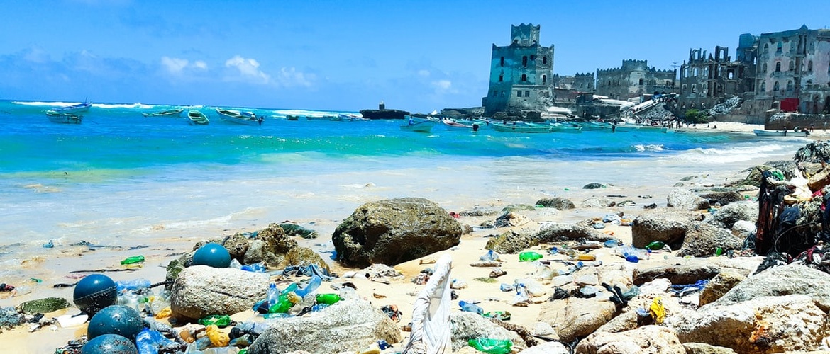 Plastic Pollution Ocean. (Photo credit: Unsplash.com)
Jaaraahorato Climate Summary
Located at an elevation of 296.2 meters (971.78 feet) above sea level, Jaaraahorato has a Subtropical steppe climate (Classification: BSh). The district’s yearly temperature is 25.41ºC (77.74ºF) and it is -2.5% lower than Somalia’s averages. Jaaraahorato typically receives about 73.17 millimeters (2.88 inches) of precipitation and has 129.04 rainy days (35.35% of the time) annually.
| Country | Somalia |
| City | Awdal |
| Longitude | 43.329466 |
| Latitude | 10.6334285 |
| Attitude/Elevation | 296.2m (971.78ft) |
| Local time | Wednesday 16:07 |
| Annual high temperature | 29.73ºC (85.51ºF) |
| Annual low temperature | 18.66ºC (65.59ºF) |
| Average annual precip. | 73.17mm (2.88in) |
| Warmest month | June (33.24ºC / 91.83ºF) |
| Coldest Month | January (13.83ºC / 56.89ºF) |
| Wettest Month | August (192.88mm / 7.59in) |
| Driest Month | January (3.87mm / 0.15in) |
| Number of days with rainfall (≥ 1.0 mm) | 129.04 days (35.35%) |
| Days with no rain | 235.96 days (64.65%) |
| Humidity | 57.64% |
Climate Jaaraahorato: Weather By Month
| Month | Jan | Feb | Mar | Apr | May | Jun | Jul | Aug | Sep | Nov | Oct | Dec | Year |
|---|---|---|---|---|---|---|---|---|---|---|---|---|---|
| Record high °C (°F) | 29.86(85.75) | 33.06(91.51) | 35.19(95.34) | 35.19(95.34) | 35.19(95.34) | 37.32(99.18) | 36.26(97.27) | 35.19(95.34) | 35.19(95.34) | 34.12(93.42) | 31.99(89.58) | 28.79(83.82) | 37.32(99.18) |
| Average high °C (°F) | 26.13(79.03) | 28.09(82.56) | 30.24(86.43) | 30.78(87.4) | 31.69(89.04) | 33.24(91.83) | 31.64(88.95) | 31.11(88.0) | 31.48(88.66) | 29.76(85.57) | 27.29(81.12) | 25.33(77.59) | 29.73(85.51) |
| Daily mean °C (°F) | 21.17(70.11) | 23.09(73.56) | 25.65(78.17) | 26.91(80.44) | 27.82(82.08) | 28.56(83.41) | 27.3(81.14) | 27.11(80.8) | 27.67(81.81) | 25.64(78.15) | 23.06(73.51) | 20.93(69.67) | 25.41(77.74) |
| Average low °C (°F) | 13.83(56.89) | 15.85(60.53) | 18.66(65.59) | 20.82(69.48) | 21.38(70.48) | 21.0(69.8) | 20.73(69.31) | 20.83(69.49) | 21.4(70.52) | 18.76(65.77) | 16.42(61.56) | 14.33(57.79) | 18.66(65.59) |
| Record low °C (°F) | 8.53(47.35) | 9.6(49.28) | 11.73(53.11) | 10.66(51.19) | 17.06(62.71) | 19.2(66.56) | 14.93(58.87) | 17.06(62.71) | 17.06(62.71) | 11.73(53.11) | 10.66(51.19) | 8.53(47.35) | 8.53(47.35) |
| Average precipitation mm (inches) | 3.87(0.15) | 32.71(1.29) | 81.34(3.2) | 117.65(4.63) | 128.21(5.05) | 35.46(1.4) | 111.5(4.39) | 192.88(7.59) | 115.12(4.53) | 35.02(1.38) | 19.89(0.78) | 4.47(0.18) | 73.18(2.88) |
| Average precipitation days (≥ 1.0 mm) | 0.97 | 4.46 | 11.63 | 17.65 | 14.83 | 6.4 | 17.06 | 27.44 | 19.1 | 5.43 | 2.91 | 1.16 | 10.75 |
| Average relative humidity (%) | 62.73 | 61.06 | 57.99 | 62.49 | 59.27 | 52.03 | 54.18 | 54.73 | 52.67 | 50.81 | 62.75 | 60.98 | 57.64 |
| Mean monthly sunshine hours | 11.53 | 12.25 | 12.14 | 12.96 | 13.53 | 13.65 | 13.52 | 13.45 | 13.18 | 12.36 | 10.19 | 9.22 | 12.33 |
Climate Graph
The chart below shows the mean monthly temperature and precipitation of Jaaraahorato in recent years.

Jaaraahorato Temperature by Month
| June | 28.56°C | 83.41°F | |
| May | 27.82°C | 82.08°F | |
| September | 27.67°C | 81.81°F | |
| July | 27.3°C | 81.14°F | |
| August | 27.11°C | 80.8°F | |
| April | 26.91°C | 80.44°F | |
| March | 25.65°C | 78.17°F | |
| October | 25.64°C | 78.15°F | |
| February | 23.09°C | 73.56°F | |
| November | 23.06°C | 73.51°F | |
| January | 21.17°C | 70.11°F | |
| December | 20.93°C | 69.67°F |
Historical Data
| Temperature | Max | Average | Min | |
|---|---|---|---|---|
| Max Temperature | 33.06°C (91.51°F) | 31.0°C (87.8°F) | 28.79°C (83.82°F) | |
| Avg Temperature | 28.79°C (83.82°F) | 27.18°C (80.92°F) | 25.59°C (78.06°F) | |
| Min Temperature | 22.39°C (72.3°F) | 20.88°C (69.58°F) | 20.26°C (68.47°F) | |
| Dew Point | Max | Average | Min | |
| Dew Point | 16.0°C (60.8°F) | 14.28°C (57.7°F) | 12.8°C (55.04°F) | |
| Precipitation | Max | Average | Min | Sum |
| Precipitation | 17.38mm | 0.68in | 6.92mm | 0.27in | 0.43mm | 0.02in | 214.66mm | 8.45in |
| Snowdepth | 0.0mm | 0in | 0.0mm | 0in | 0.0mm | 0in | 0.0mm | 0in |
| Wind | Max | Average | Min | |
| Wind | 30.93kmh | 19.22mph | 21.5kmh | 13.36mph | 14.93kmh | 9.28mph | |
| Gust Wind | 41.59kmh | 25.84mph | 29.58kmh | 18.38mph | 20.26kmh | 12.59mph | |
| Sea Level Pressure | Max | Average | Min | |
| Sea Level Pressure | 17.38mb | 6.92mb | 0.43mb |

Daily Observations
| Time | Temperature | Dew Point | Humidity | Wind Speed | Pressure | Precipitation |
|---|---|---|---|---|---|---|
| August | ° C | ° F | ° C | ° F | % | Kph | Mph | Hg | Mb | Total (mm/in) |
| 2012-08-01 | 26.66 | 79.99 | 13.86 | 56.95 | 54 | 21.33 | 13.25 | 31.77 | 1076.0 | 5.01 | 0.2 |
| 2012-08-02 | 26.66 | 79.99 | 14.93 | 58.87 | 57 | 26.66 | 16.57 | 31.81 | 1077.06 | 3.63 | 0.14 |
| 2012-08-03 | 26.66 | 79.99 | 14.93 | 58.87 | 57 | 30.93 | 19.22 | 31.81 | 1077.06 | 7.57 | 0.3 |
| 2012-08-04 | 26.66 | 79.99 | 13.86 | 56.95 | 52 | 27.73 | 17.23 | 31.77 | 1076.0 | 2.99 | 0.12 |
| 2012-08-05 | 26.66 | 79.99 | 14.93 | 58.87 | 52 | 22.39 | 13.91 | 31.77 | 1076.0 | 11.73 | 0.46 |
| 2012-08-06 | 26.66 | 79.99 | 14.93 | 58.87 | 53 | 24.53 | 15.24 | 31.74 | 1074.93 | 5.97 | 0.24 |
| 2012-08-07 | 27.73 | 81.91 | 13.86 | 56.95 | 51 | 22.39 | 13.91 | 31.74 | 1074.93 | 13.44 | 0.53 |
| 2012-08-08 | 26.66 | 79.99 | 13.86 | 56.95 | 51 | 26.66 | 16.57 | 31.77 | 1076.0 | 7.89 | 0.31 |
| 2012-08-09 | 26.66 | 79.99 | 14.93 | 58.87 | 54 | 25.59 | 15.9 | 31.81 | 1077.06 | 12.16 | 0.48 |
| 2012-08-10 | 26.66 | 79.99 | 13.86 | 56.95 | 51 | 29.86 | 18.55 | 31.77 | 1076.0 | 7.14 | 0.28 |
| 2012-08-11 | 27.73 | 81.91 | 13.86 | 56.95 | 50 | 29.86 | 18.55 | 31.77 | 1076.0 | 0.43 | 0.02 |
| 2012-08-12 | 27.73 | 81.91 | 13.86 | 56.95 | 47 | 20.26 | 12.59 | 31.74 | 1074.93 | 3.31 | 0.13 |
| 2012-08-13 | 27.73 | 81.91 | 13.86 | 56.95 | 50 | 14.93 | 9.28 | 31.74 | 1074.93 | 11.84 | 0.47 |
| 2012-08-14 | 27.73 | 81.91 | 13.86 | 56.95 | 50 | 19.2 | 11.93 | 31.77 | 1076.0 | 7.78 | 0.31 |
| 2012-08-15 | 26.66 | 79.99 | 14.93 | 58.87 | 53 | 18.13 | 11.27 | 31.74 | 1074.93 | 17.38 | 0.68 |
| 2012-08-16 | 26.66 | 79.99 | 13.86 | 56.95 | 52 | 16.0 | 9.94 | 31.74 | 1074.93 | 9.6 | 0.38 |
| 2012-08-17 | 25.59 | 78.06 | 13.86 | 56.95 | 54 | 20.26 | 12.59 | 31.77 | 1076.0 | 9.38 | 0.37 |
| 2012-08-18 | 25.59 | 78.06 | 14.93 | 58.87 | 56 | 19.2 | 11.93 | 31.81 | 1077.06 | 10.77 | 0.42 |
| 2012-08-19 | 26.66 | 79.99 | 13.86 | 56.95 | 51 | 14.93 | 9.28 | 31.81 | 1077.06 | 4.05 | 0.16 |
| 2012-08-20 | 27.73 | 81.91 | 12.8 | 55.04 | 46 | 24.53 | 15.24 | 31.74 | 1074.93 | 3.2 | 0.13 |
| 2012-08-21 | 27.73 | 81.91 | 13.86 | 56.95 | 51 | 23.46 | 14.58 | 31.74 | 1074.93 | 2.99 | 0.12 |
| 2012-08-22 | 27.73 | 81.91 | 12.8 | 55.04 | 48 | 20.26 | 12.59 | 31.77 | 1076.0 | 5.12 | 0.2 |
| 2012-08-23 | 27.73 | 81.91 | 13.86 | 56.95 | 47 | 17.06 | 10.6 | 31.74 | 1074.93 | 2.77 | 0.11 |
| 2012-08-24 | 28.79 | 83.82 | 12.8 | 55.04 | 45 | 14.93 | 9.28 | 31.74 | 1074.93 | 2.13 | 0.08 |
| 2012-08-25 | 27.73 | 81.91 | 14.93 | 58.87 | 51 | 14.93 | 9.28 | 31.77 | 1076.0 | 4.37 | 0.17 |
| 2012-08-26 | 27.73 | 81.91 | 16.0 | 60.8 | 55 | 17.06 | 10.6 | 31.77 | 1076.0 | 4.59 | 0.18 |
| 2012-08-27 | 27.73 | 81.91 | 14.93 | 58.87 | 52 | 20.26 | 12.59 | 31.77 | 1076.0 | 2.13 | 0.08 |
| 2012-08-28 | 27.73 | 81.91 | 14.93 | 58.87 | 52 | 24.53 | 15.24 | 31.77 | 1076.0 | 5.65 | 0.22 |
| 2012-08-29 | 27.73 | 81.91 | 14.93 | 58.87 | 52 | 22.39 | 13.91 | 31.81 | 1077.06 | 3.41 | 0.13 |
| 2012-08-30 | 27.73 | 81.91 | 13.86 | 56.95 | 49 | 16.0 | 9.94 | 31.81 | 1077.06 | 11.94 | 0.47 |
| 2012-08-31 | 26.66 | 79.99 | 16.0 | 60.8 | 56 | 20.26 | 12.59 | 31.77 | 1076.0 | 14.29 | 0.56 |
Jaaraahorato 11 Year Historical Weather Data
- Jaaraahorato, Awdal weather in August 2010
- Jaaraahorato, Awdal weather in August 2011
- Jaaraahorato, Awdal weather in August 2013
- Jaaraahorato, Awdal weather in August 2014
- Jaaraahorato, Awdal weather in August 2015
- Jaaraahorato, Awdal weather in August 2016
- Jaaraahorato, Awdal weather in August 2017
- Jaaraahorato, Awdal weather in August 2018
- Jaaraahorato, Awdal weather in August 2019
- Jaaraahorato, Awdal weather in August 2020
Nearby locations
- Biyafoge 0.00 km ( 0.00 mi)
- Araqolab 0.00 km ( 0.00 mi)
- Dabacaddo 0.00 km ( 0.00 mi)
- Abdelcader 0.00 km ( 0.00 mi)
- Mashruuca Dibira Weyn 0.00 km ( 0.00 mi)
- Jaglaleh 0.00 km ( 0.00 mi)
- Fulla 0.00 km ( 0.00 mi)
- Tokhoshi 0.00 km ( 0.00 mi)
- Shakab 0.00 km ( 0.00 mi)
- Hadeytacawl 0.00 km ( 0.00 mi)
- Hemal 0.00 km ( 0.00 mi)
- Karinkarin 0.00 km ( 0.00 mi)
- Tuur Qaylo 0.00 km ( 0.00 mi)
- Abakor Cadaawe 0.00 km ( 0.00 mi)
- Baysaare 0.00 km ( 0.00 mi)
- Warabood 0.00 km ( 0.00 mi)
- Dara Woha 0.00 km ( 0.00 mi)
- Xuseen 14.83 km ( 9.21 mi)
- Jidhi 31.10 km ( 19.32 mi)
- Weeraar 40.93 km ( 25.43 mi)
- Sillil 42.11 km ( 26.16 mi)
- Bukh 53.41 km ( 33.19 mi)
- Garbodadar 54.50 km ( 33.86 mi)
- Ceel Baxay 55.08 km ( 34.23 mi)
- Cabaasa 56.44 km ( 35.07 mi)
- Kalawle 57.97 km ( 36.02 mi)
- Waraqadhigta 59.12 km ( 36.73 mi)
- Cadaad 61.85 km ( 38.43 mi)
- Gargaara 63.06 km ( 39.18 mi)
- Sabawanaag 67.71 km ( 42.07 mi)
- Lughaye 67.71 km ( 42.07 mi)
- Ruqi 74.18 km ( 46.09 mi)
- Boorama 78.76 km ( 48.94 mi)
- Walaalgo 84.84 km ( 52.71 mi)
- Gorayacowl 85.42 km ( 53.08 mi)
- Xoorey 110.57 km ( 68.71 mi)
- Shiikh Awaare 217.06 km ( 134.87 mi)
- Gerisa 406.37 km ( 252.50 mi)
- Carmaale 507.04 km ( 315.06 mi)
- View all
Comments (0)
- Latest first
- Highest rated
Be the first to comment on this page